The storm turns El Torcal Alto white and leaves more than 20 liters in the province
The instability will continue for the rest of the week with about a 50% chance of rain on Christmas Eve and Christmas Day.
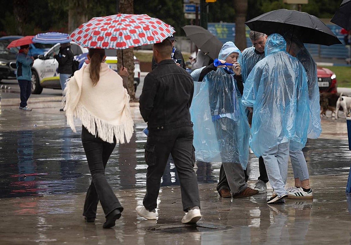

The arrival of winter was felt yesterday, Sunday, in Málaga with unpleasant weather, characterized by a drop in temperatures, widespread precipitation ... and the first snowfall of the season, which blanketed El Torcal in white. It was a day that met the forecasts: light to moderate rains, occasionally intense in some areas, which led Aemet to activate the yellow warning in Axarquía until 2:00 PM.
Although in the capital the rain remained constant during the middle of the day, there were no notable records: 10.8 liters were recorded at the Meteorological Center (Teatinos) and 6.8 at the airport.
However, this succession of fronts associated with a low-pressure system affecting the entire country since Friday, left accumulations of over 20 liters in numerous points of the province this weekend, as recorded by the Red Hidrosur: Cortes de la Frontera (27.8), Cañete la Real (26.2), Gaucín (25.2), Cuevas del Becerro (23.9), Nerja (23.6), Fuengirola (21.6), Ronda (21.1), Fuente de Piedra (21) and Casarabonela (20.1).
Significant records were also seen in the Guadalhorce River (Bobadilla) with 25.6 liters in the last 24 hours, Genal River (23.3), Turón River (20.2), Guadalteba (17.6), and Guadiaro (18.3). And this generous distribution of rain has been reflected in the increase of reservoir levels, which generally grew by about one cubic hectometer last week; nearly two in La Viñuela, which went from 70.27 hm3 to 72.24.
View this post on InstagramReservoir Levels
The only reservoir that decreased in level was the Limonero dam, which went from 11.18 to 11.09 hm3, although it is the infrastructure with the most reserves, being at 79.21% of its capacity.
There were no notable incidents, just water accumulations on the roads of the Coast, which required drivers to be extra cautious, and some localized flooding, such as those recorded on the promenade of Fuengirola, according to José Carlos García, where two small streams on the Rey de España promenade, in the area of the Torreblanca del Sol neighborhood, tend to cause problems whenever it rains. Additionally, the storm affected Santa Amalia beach, with sand loss, although it is still pending analysis by the City Council.
Málaga, accustomed to mild temperatures, also felt the drop in thermometers which will continue to fall this week. Today, the forecast is that the maximum will not exceed 14 degrees and the minimum will drop to 7. The trend will continue the rest of the days. According to Aemet, for Christmas Eve and Christmas, maximums between 15-16 degrees and minimums between 8-10 are expected. In general, the weather will remain unstable throughout the week. Today is a transition day with no rain expected, but on Tuesday the probability of showers rises to 75%; on Wednesday, Christmas Eve, it drops to 50% between 12:00 PM and midnight, and on Thursday, to 55%.
This drop in mercury, accompanied by the precipitation that occurred yesterday, left the first white landscape of the province. From noon, the snow did not stop falling in El Torcal and after several hours it covered this natural area with a white blanket.

Latest news



Upcoming events
12
Nov
El Desembarco, la traición de Viriato at La Caja Blanca
12
Nov
HOMER El Mero Mero at Sala Trinchera Málaga
13
Nov
Marbella Startup Lab – Innovate & Collaborate
13
Nov
Candlelight: Coldplay & Imagine Dragons at Sala Fundación Unicaja María Cristina
13
Nov
Candlelight: Tribute to Ludovico Einaudi at Anantara Villa Padierna
Similar News

Málaga Airport Makes History with More Than Three Million Passengers in One Month
Málaga
Port of Málaga looks beyond its docks to support future growth
Málaga
Guide to the Virgen del Carmen Processions in Málaga and the Province
Málaga