Four essential hiking trails to enjoy autumn in Malaga: easy, beautiful, and full of history
Trails among mountains, valleys, and towns that experience autumn with special intensityItineraries that combine nature, history, and unique landscapes after the first rainsMijas, Benalmádena, Alameda, Alfarnate, and Cuevas Bajas take center stage
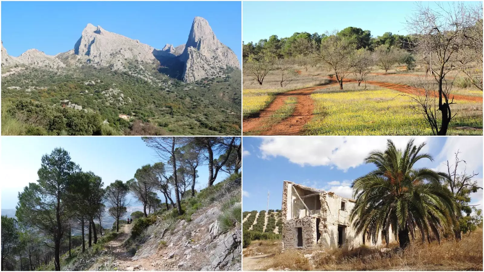

Autumn transforms Málaga into a paradise for those looking to connect with nature. The milder temperatures and changing landscapes make this season an ideal time to explore some of the most representative trails of the province, which become more vibrant and colorful after the rains. Within this network, the Gran Senda de Málaga stands out as one of the main references for discovering the territory step by step. Its network of itineraries connects towns, mountain ranges, and valleys, offering routes that vary greatly in length, difficulty, and scenic appeal. Among them, four routes are particularly interesting during this time of year, all marked by the combination of nature and history that characterizes the province.
Route between Mijas and Benalmádena: a connection between the mountains and the Mediterranean
Stage 33 of the Gran Senda de Málaga, covering 18 kilometers, links two of the most emblematic municipalities of the Costa del Sol: Mijas and Benalmádena. It is a linear route of easy difficulty, designed as a relaxed day among landscapes where the sea and the mountains coexist in a surprising way.
Powered by WikilocThe trail starts in the urban area of Mijas, ascending through a Via Crucis that leads to the Ermita del Calvario, a historic enclave located in the heart of the mountains. From this point, panoramic views open up towards the coast and, on clear days, even towards the African coasts. The route then proceeds through the mountains shared by Mijas and Benalmádena, also skirting areas near Alhaurín de la Torre. The final part descends towards Benalmádena, completing a journey where geographical contrasts become the protagonists.
From Alameda to Fuente de Piedra: a long journey through mountains and plains
For those who prefer longer routes, Stage 17 of the Gran Senda de Málaga offers an option of nearly 19 kilometers connecting Alameda with Fuente de Piedra. Although its estimated duration is between seven and eight hours, its difficulty is low, making it accessible for walkers accustomed to long journeys.
Powered by WikilocThe starting point in Alameda places the hiker in the area known as Loma El Ventorrillo, a historic crossroads between three municipalities. The path advances through the Sierras de la Camorra and Mollina, where landscapes of dry tones and gentle reliefs predominate. As the journey progresses, the environment gradually changes until it leads to the fertile lands of the Vega de Antequera. The arrival at Fuente de Piedra, a town associated with its emblematic lagoon and the presence of flamingos, concludes an itinerary that combines natural history and landscape transition.
Alfarnatejo – Alfarnate: a journey between mountain ranges and cliffs
Stage 10 of the Gran Senda, which connects Alfarnatejo and Alfarnate, stretches for 16.6 kilometers and presents a medium difficulty. It is an ideal route for those who wish to delve into the mountainous landscapes of the Axarquía, characterized by steep reliefs and a vegetation very representative of the interior of Málaga.
Powered by WikilocThe start is located in Pulgarín Alto, a hamlet of Alfarnatejo, from where the route advances between the Antequera Mountain Range and the depression of Alfarnate. The path offers views of rock formations such as the tajos of Doña Ana and Gomer, notable for their imposing presence. The trail mostly runs alongside the Sabar River, crossing small bridges and open channels that accompany the journey. Throughout the route, it is possible to observe holm oaks, gall oaks, poplars, and dryland olive groves, a clear example of the native flora of this region.
Villanueva de Algaidas – Cuevas Bajas: rural history in an accessible journey
Those who prefer shorter distances find in Stage 15 of the Gran Senda a comfortable and accessible option of 10 kilometers between Villanueva de Algaidas and Cuevas Bajas. Its low difficulty and an approximate duration of three hours make it a route suitable for hikers of different experience levels.
Powered by WikilocThe route begins in Villanueva de Algaidas with the ascent to Cerro de la Cruz, a high point from which wide views of the Genil River plains can be obtained. One of the peculiarities of the journey is its proximity to historical elements of great value, such as the ruins of the 16th-century convent of Nuestra Señora de la Consolación, and a 9th-century Mozarabic hermitage. The trail ends in Cuevas Bajas, completing an itinerary where nature and rural heritage coexist throughout the journey.

Latest news




Upcoming events
12
Nov
El Desembarco, la traición de Viriato at La Caja Blanca
12
Nov
HOMER El Mero Mero at Sala Trinchera Málaga
13
Nov
Marbella Startup Lab – Innovate & Collaborate
13
Nov
Candlelight: Coldplay & Imagine Dragons at Sala Fundación Unicaja María Cristina
13
Nov
Candlelight: Tribute to Ludovico Einaudi at Anantara Villa Padierna
Similar News

Málaga Airport Makes History with More Than Three Million Passengers in One Month
Málaga

Port of Málaga looks beyond its docks to support future growth
Málaga

Guide to the Virgen del Carmen Processions in Málaga and the Province
Málaga