Malaga escapes the second part of the heatwave, but with very high minimum temperatures
The nights will be torrid or equatorial almost every day this week, when the temperature will not drop below 25 degrees.
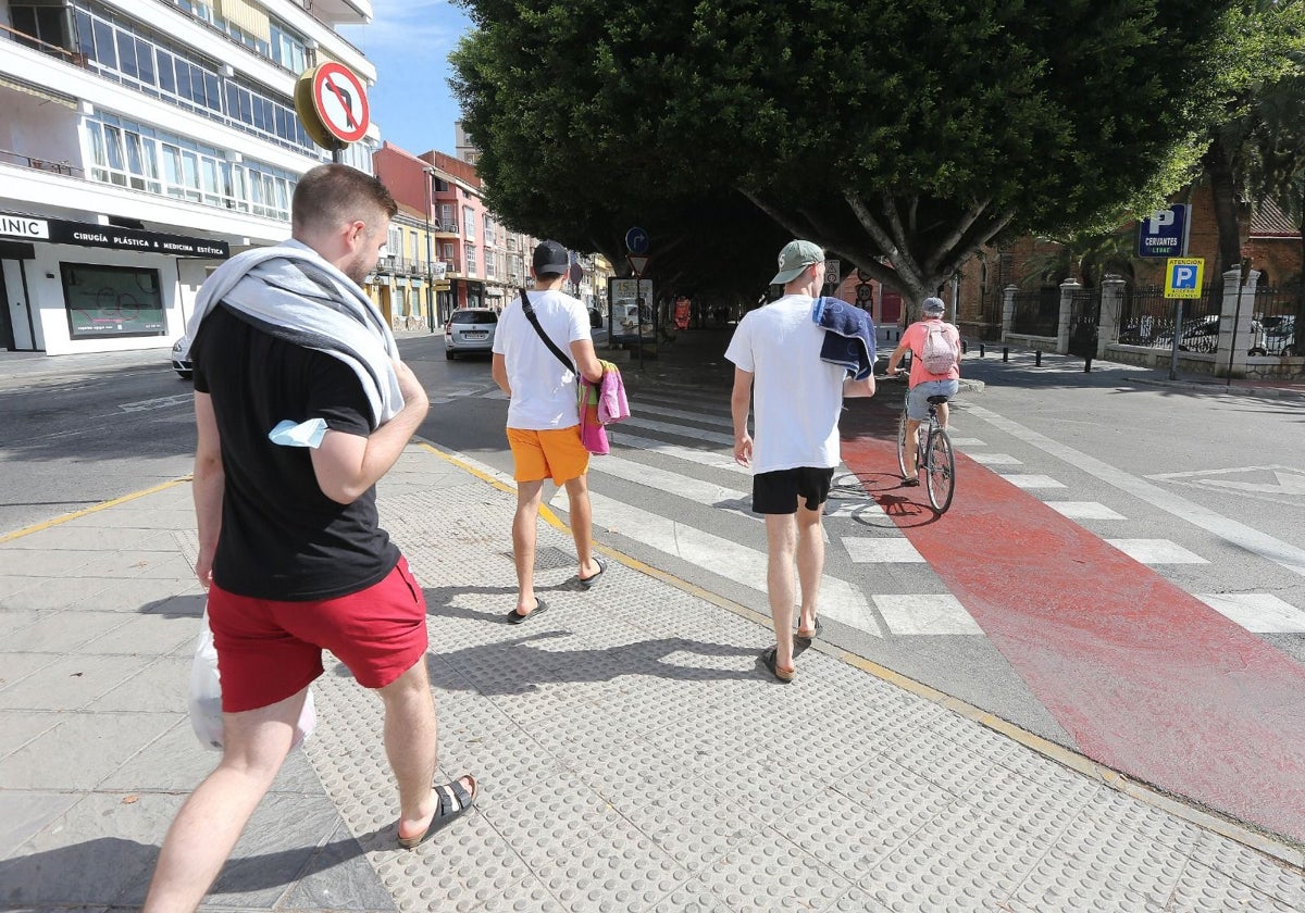

This week, the weather in Málaga will be a mixed bag. On the positive side, while most of the Iberian map is colored in orange and yellow due to weather warnings, most of the province of Málaga and the Costa del Sol will once again dodge the second part of the heatwave, which is expected to last at least until Wednesday. Only the region of Antequera has an active (mild) warning for this Tuesday, August 12, where temperatures could locally reach up to 40 degrees Celsius.
This is a far cry from the capital of Málaga and the Costa del Sol, where in the middle of August, the maximum temperatures are within the usual range, between 31 and 33 degrees Celsius. This is far from the 44 degrees and more that the thermometer is hitting in some inland parts of Andalusia and the peninsula. This is due to the prevalence of the Levante wind, which tends to moderate temperatures but adds a lot of humidity to the environment.
Related News
Red warning in Andalusia due to heat
However, there is a concerning aspect in Aemet's forecast. This week, the nighttime minimums will be particularly high. The worst is expected today, when the mercury will not drop below 27 degrees during the early morning hours, making it very difficult to sleep at night without the aid of air conditioning and fans.
27
degrees is the minimum forecast for tonight in Málaga, which will be the hottest night. The rest of the week will hover around 25 degrees, according to Aemet's forecast.
But the rest of the week will be almost the same, according to what is expected by the State Agency on its website. Wednesday night is expected to have a minimum of 26 degrees; and 25 on Thursday.
Thus, there will be what is called in meteorological language "torrid or equatorial nights," a concept that refers to those early mornings when the minimum temperature does not drop below 25 degrees. This already exceeds the more well-known term "tropical night," which is used for minimums between 20 and 25 degrees. Although it is still far from the so-called "infernal nights," which are those in which the mercury does not drop below 30.
Start of the fair
Therefore, at the start of the fair, the most notable feature will be the heat during the early mornings. For the Night of the Fireworks, Aemet forecasts a minimum of 25 degrees. However, during the day on the first weekend, the maximum will be 33 degrees on Sunday. Awaiting the thermal sensation caused by the high relative humidity, the beginning of the festivities in the capital are not expected to be especially hot.
25
degrees is the forecast temperature during the Night of the Fireworks, which will kick off the Málaga fair.
José Luis Escudero, an expert in Málaga's meteorology and head of the Tormentas y Rayos blog (on SUR.es), has analyzed the data from Aemet's official thermometers since August 3, when the second heatwave of the summer of 2025 began in Spain. Specifically, his analysis includes data on maximum and minimum temperatures from the airport and port stations.
Just yesterday (Monday), the port station did not drop below 25 degrees at any time during the night, "as in other areas of the capital close to the sea, as is the case with my station in Ortega y Gasset. That is, we had a torrid night and early morning." However, at the Airport and Meteorological Center (El Cónsul) stations, temperatures hovered around 24.4 degrees, making it a tropical night. The sea water temperature is around 27 degrees.
Thus, including last night, in Málaga, during this heatwave episode, the 25-degree threshold has been exceeded on three occasions at the port (due to its proximity to the sea, where the water is warm). This occurred on the 6th, 8th, and 11th. Meanwhile, at the airport, it has generally been lower, and only reached this threshold during one night (the 8th).
No heatwave
This study also confirms that Málaga has behaved since the beginning of August as an oasis in Spain, and has not even come close to the typical values of a heatwave. In fact, the maximums have remained very stable in this first ten days of the month, both at the airport and the port thermometers, within a range of 30 to 33 degrees.
In contrast, the scenario in the rest of Andalusia and much of Spain is a mix of red, yellow, and orange warnings, from which, along with the Costa del Sol coast, only a handful of provinces are spared, due to the second part of this long heatwave, which is on its way to ten consecutive days.
Today, Aemet has activated a red level warning (extreme risk) due to the possibility that temperatures could reach, and even exceed, 44 degrees in the Sevillian countryside, between 1:00 PM and 9:00 PM. Meanwhile, almost all of the interior of Andalusia will be under an orange warning, especially in the Cordoban countryside, where temperatures are expected to generally reach 43 degrees and could occasionally also reach 44 degrees.

Latest news




Upcoming events
12
Nov
El Desembarco, la traición de Viriato at La Caja Blanca
12
Nov
HOMER El Mero Mero at Sala Trinchera Málaga
13
Nov
Marbella Startup Lab – Innovate & Collaborate
13
Nov
Candlelight: Coldplay & Imagine Dragons at Sala Fundación Unicaja María Cristina
13
Nov
Candlelight: Tribute to Ludovico Einaudi at Anantara Villa Padierna
Similar News
Málaga Airport Makes History with More Than Three Million Passengers in One Month
Málaga
Port of Málaga looks beyond its docks to support future growth
Málaga
Guide to the Virgen del Carmen Processions in Málaga and the Province
Málaga