14 kayaking and stand-up paddleboarding routes to explore the coast of Málaga by the stroke of a paddle
The Senda Litoral offers 14 kayaking and stand-up paddleboarding routes along the coast of Málaga: fossilised dunes, cliffs, watchtowers and seagrass beds.
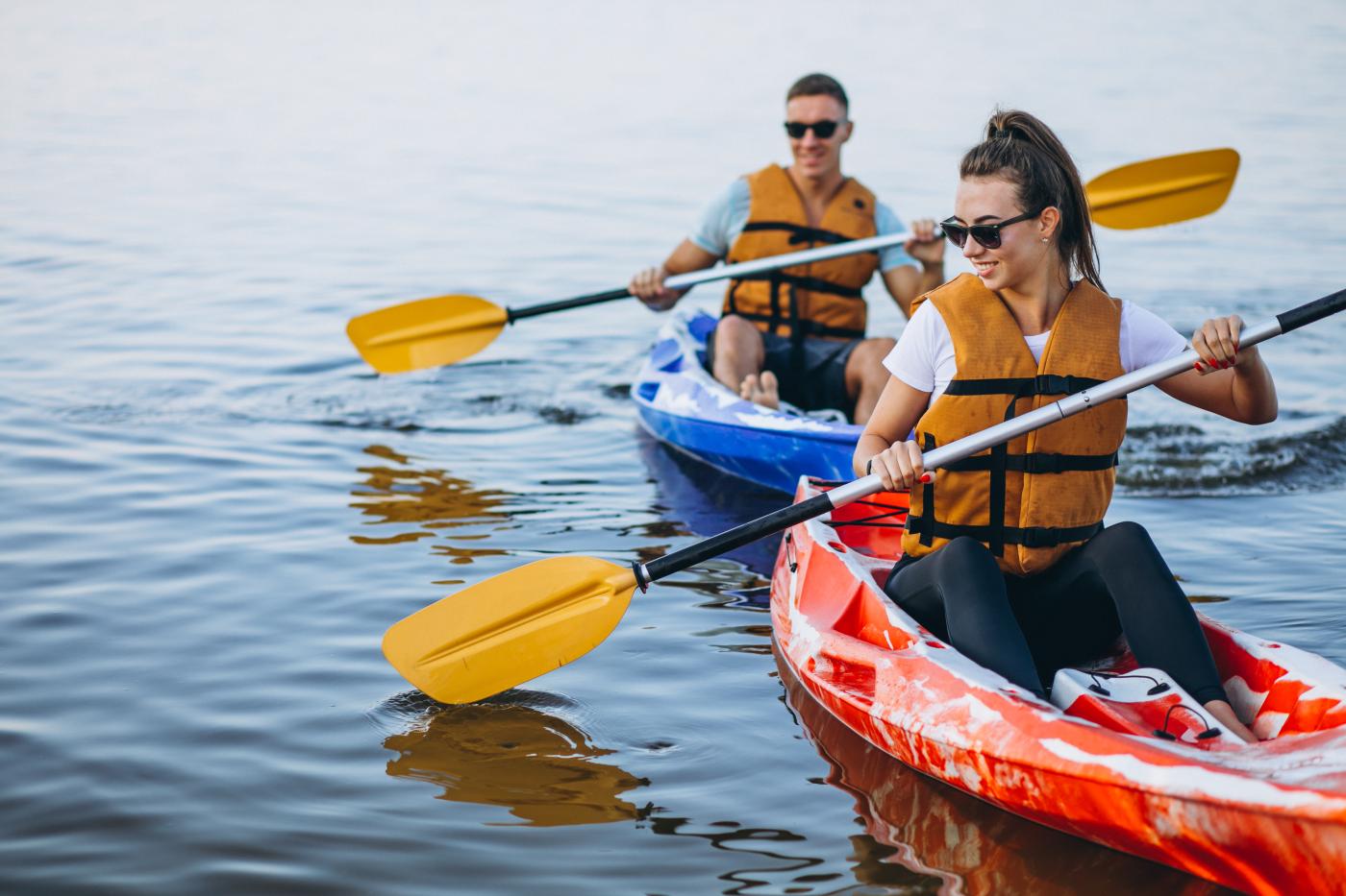

The Málaga coastline offers a lot more than beaches to sunbathe on. More and more enthusiasts are discovering it from a different angle, paddling a stand-up paddleboard or a kayak. To showcase some of the most striking corners of the Andalusian Mediterranean, the Senda Litoral has mapped out a network of 14 water trails spread across the province's coastal towns. Together, they add up to nearly 60 kilometers of marked routes, running from Punta Chullera in Manilva all the way to the beaches of Nerja, revealing fossil dunes, cliffs, seagrass meadows, watchtowers, hidden coves, and some of the most iconic landscapes of the Costa del Sol and the Axarquía.
While the project also includes snorkeling and diving routes, the kayak and paddleboard trails are the most accessible for the general public. The routes are split between the western Costa del Sol and Málaga's eastern coast, with options ranging from a simple family outing to routes that let you take in landmarks like the Balcón de Europa, the Artola Dunes, Peñón del Cuervo, or the El Cantal Cliffs from the water.
Safety Tips Before Heading Out on the Water
Before paddling out, it's worth keeping in mind a few precautions that apply to nearly every route:
- Always check the weather forecast and sea conditions before setting out.
- Paddle parallel to the shore, without straying too far from land.
- Keep your phone protected in a waterproof case.
- Avoid days with offshore winds — such as the terral or certain westerly wind episodes — since they can easily sweep boards and boats out to sea.
- If you run into trouble, never let go of your board or kayak: it's your main source of flotation and visibility, and makes it much easier for help to find you.
Western Costa del Sol
1. Punta Chullera – Cala Sardina (Manilva)
This route reveals one of the most unspoiled and lesser-known sights along the entire Málaga coast. The paddle runs past long stretches of beach that have escaped large-scale development, offering a privileged view of Punta Chullera, one of the western coastline's most distinctive spots.
The star of the route is Playa de los Toros, where a striking fossil dune formed millions of years ago on the seabed emerges from the sand. Its characteristic sandy-gold color contrasts with the darker sand carried down from nearby mountains, creating one of the province's most eye-catching geological landscapes.
- Length: 5 kilometers
- Estimated duration: 1.5 hours
- Point of interest: Playa de los Toros and the Punta Chullera fossil dune
2. Playa Chica – Piedra Paloma (Casares)
Located close to the Strait of Gibraltar, this water trail combines long open beaches with small coves and rocky outcrops. Its proximity to the main migratory corridor between Europe and Africa makes it a great spot for observing seabirds and land birds during migration season.
The route has two distinct halves: the first runs alongside wide sandy stretches with areas set aside for nesting wading birds, while the second turns wilder, dominated by the historic Torre de la Sal, an old watchtower once used to keep watch over this stretch of coast.
- Length: 4 kilometers
- Estimated duration: 1.5 hours
- Point of interest: Torre de la Sal and the Piedra Paloma area
3. Torre de Arroyo Vaquero – Piedra Paloma (Estepona)
This trail brings together some of the most characteristic landscape features of the westernmost Costa del Sol. Along the way, the silhouette of the Rock of Gibraltar accompanies you as you paddle south, while Sierra Bermeja looms inland on the horizon with its unmistakable reddish tones.
The route alternates between wide beaches and rock formations of great geological interest, including the small flysch-type reef at Islote de las Palomas and, above all, Piedra Paloma — a massive rock split and hollowed out by sea erosion, rising several meters above the water and now one of the great symbols of this stretch of coast.
- Length: 4 kilometers
- Estimated duration: 1.5 hours
- Point of interest: Piedra Paloma and Islote de las Palomas
4. Artola Dunes – Cabopino (Marbella)
Few routes let you take in one of the Costa del Sol's most valuable natural areas from the water. This route paddles past the Artola-Cabopino dune system, where dunes, coastal pine forest, and beaches form one of the best-preserved landscapes on the Málaga coast.
The paddle runs parallel to a stretch of coastline that's almost entirely free of buildings, offering an unusual view of the Senda Litoral's wooden boardwalk. Near the Cabopino breakwater, sandbars help create small waves that make this spot especially popular with paddleboarding enthusiasts.
- Length: just over 3 kilometers
- Estimated duration: 1 hour
- Point of interest: Artola Dunes and Cabopino marina
5. From Tower to Tower (Mijas)
This route takes its name from the Calahonda and Torrenueva watchtowers, two historic structures that for centuries formed part of the Málaga coast's defense system against pirate raids. Today they serve as visual landmarks for one of the Senda Litoral's most interesting paddles.
One of the route's biggest draws lies beneath the surface: it passes through areas where seagrass meadows help keep the water remarkably clear, making it easy to see the seabed below. The appeal here isn't just the coastal scenery, but also the ecosystem hidden beneath the waves.
- Length: 6 kilometers
- Estimated duration: 2 hours
- Point of interest: the Calahonda and Torrenueva towers, and seagrass meadows
6. Urban Paddle at Sunrise and Sunset (Fuengirola)
This route offers a different kind of experience compared to the province's other water trails. Rather than focusing on natural areas or geological landmarks, it invites paddlers to take in Fuengirola from the sea during the most photogenic moments of the day, when the light completely transforms the look of the city.
The route runs parallel to the seafront promenade and can easily be adjusted to whatever distance each paddler prefers. The calm that usually settles over the water early and late in the day contrasts with the buzz of one of the Costa del Sol's biggest tourist destinations, creating a surprisingly peaceful experience.
- Length: over 6 kilometers
- Estimated duration: 2.5 hours
- Point of interest: the seafront promenade and the marina area
7. Benalmádena Cliffs
This trail covers one of the most spectacular and rugged stretches of the Costa del Sol. The paddle runs alongside a series of cliffs and small coves, where large geological folds rise almost vertically from the sea, offering a very different image from the urban beaches of the neighboring towns.
The route offers a closer look at this stretch of coast's complex geological history, and invites paddlers to make short stops at some of the many coves tucked beneath the cliffs. Without question, one of the most visually striking routes on the list.
- Length: 5 kilometers
- Estimated duration: 1.5 hours
- Point of interest: the cliffs and coves of the Benalmádena coastline
8. El Saltillo – Santa Clara (Torremolinos)
La Carihuela takes center stage on this route, designed especially for those just getting started with kayaking or paddleboarding. It runs along one of the Costa del Sol's best-known beaches and combines generally calm water with a wide range of services and specialized schools.
The numerous sandbanks in the area, particularly near the marina, help create small waves that are ideal for learning or fine-tuning your technique. Exploring this historic tourist spot from the water also offers a fresh perspective on one of the places that played a key role in shaping the modern Costa del Sol.
- Length: 5 kilometers
- Estimated duration: 1.5 hours
- Point of interest: La Carihuela beach and the marina area
Eastern Coast
9. La Araña – Peñón del Cuervo (Málaga)
This water trail combines some of the best views of Málaga Bay with one of the province's most important archaeological sites. From the water, paddlers get a sweeping view of the city, with the port, the Cathedral, and the mountains ringing the bay all part of the scenery.
The route runs along a semi-cliffed coastline closely tied to prehistory. The La Araña area is home to some of the most significant archaeological sites in southern Spain, while Peñón del Cuervo offers one of the most recognizable images of the Málaga coastline. The route also invites paddlers to picture what this landscape looked like some 20,000 years ago, when sea levels were much lower and dry land — inhabited by Paleolithic groups — stretched out in front of what are now these beaches.
- Length: 2.7 kilometers
- Estimated duration: 1 hour
- Point of interest: Peñón del Cuervo and the La Araña archaeological sites
10. El Cantal Cliffs (Rincón de la Victoria)
This route reveals one of the most fascinating geological areas along the Málaga coast from the water. The paddle runs alongside the El Cantal Cliffs, where rock formations shaped over millions of years by the combined action of the sea and geological processes come into view.
The route also offers a privileged perspective on one of the town's most iconic landmarks, the Torre del Cantal watchtower. Nearby are the Cueva del Tesoro and the Cueva de la Victoria caves, two essential sites for understanding the rich archaeological and prehistoric heritage of this part of the coast. The result is a paddle where landscape, geology, and history come together.
- Length: approximately 2 kilometers
- Estimated duration: 1.5 hours
- Point of interest: the El Cantal Cliffs and the Torre del Cantal
11. Valle Niza – Almayate (Vélez-Málaga)
Although it's one of the shortest routes in the whole network, it stands out for the quality of the light during the early morning and late afternoon hours. Sunrises and sunsets turn this stretch of coast into a setting where orange and pink reflections spread across the surface of the Mediterranean.
The paddle runs parallel to the historic N-340 road and offers views of the shale and clay formations typical of much of the Axarquía coastline. Rising above one of these outcrops is the Torre del Jaral, one of the province's oldest watchtowers and the main visual landmark along the route.
- Length: 2.5 kilometers
- Estimated duration: 1 hour
- Point of interest: the Torre del Jaral
12. A Paddle Around Punta Ballenas (Algarrobo – Vélez-Málaga)
This trail covers one of the calmest stretches of Málaga's eastern coast and shows off the close relationship between mountains and sea that defines the Axarquía. Shale-covered slopes descend almost all the way to the Mediterranean, creating a landscape very typical of this region.
From the water, it's possible to see how that same shale also emerges beneath the surface, giving the water exceptional clarity. The route invites paddlers to take their time, and for those who want to, to stop and explore the seabed with a mask and snorkel in some of the clearest stretches along the way.
- Length: 3.5 kilometers
- Estimated duration: 1 hour
- Point of interest: Punta Ballenas and the shale seabed
13. Peñoncillo – Playa del Güilche (Torrox)
This route captures much of the coastal Axarquía's landscape character. Along the way, shale hillsides dotted with whitewashed houses descend toward the sea, creating an image very typical of this region, where the terrain shapes both the scenery and the way it has been settled.
The paddle runs over wide sandy seabeds and reveals a few features rarely seen from land, including a shipwreck sunk during the Spanish Civil War and the striking rock formation known as La Piedra de la Virgen — two landmarks that give this route its own distinct character.
- Length: nearly 6 kilometers
- Estimated duration: 2 hours
- Point of interest: La Piedra de la Virgen and the Civil War shipwreck
14. Las Calas del Pueblo: Torrecilla – Burriana (Nerja)
Nerja's route closes out the Senda Litoral's network of water trails with one of the most recognizable landscapes in the entire province. From the sea, paddlers get a privileged view of the Balcón de Europa, perched on a rocky promontory overlooking the coast and one of the most widely shared images in Málaga tourism.
The paddle passes a succession of travertine formations, small coves, and cliffs that showcase some of the most distinctive geological features of Andalusia's eastern coastline. It's an urban route, but with such a strong landscape element that every stretch feels like a floating viewpoint over the Nerja coast.
- Length: nearly 6 kilometers
- Estimated duration: 2 hours
- Point of interest: the Balcón de Europa and Burriana beach
Although the Senda Litoral's official route ends at Burriana beach, many kayaking and paddleboarding enthusiasts typically continue on toward Maro and the Cerro Gordo Cliffs, one of the most spectacular stretches of coastline in Andalusia.
Active Tourism Operators Along the Málaga Coast
During the summer, numerous active tourism companies run guided excursions along this stretch of coast, in addition to offering equipment rentals for those who prefer to explore on their own. That's precisely why this is also one of the busiest sections of the entire Málaga coastline during the summer season.
Reference source: diariosur.es

Latest news



Upcoming events
12
Nov
El Desembarco, la traición de Viriato at La Caja Blanca
12
Nov
HOMER El Mero Mero at Sala Trinchera Málaga
13
Nov
Marbella Startup Lab – Innovate & Collaborate
13
Nov
Candlelight: Coldplay & Imagine Dragons at Sala Fundación Unicaja María Cristina
13
Nov
Candlelight: Tribute to Ludovico Einaudi at Anantara Villa Padierna
Similar News

Japanese festival comes to Málaga this Sunday: Matsuri 2026 brings kimonos, sumo, traditional drums and food
Málaga

Sould Park Malaga to open before Christmas with rollercoasters, bowling and mini golf
Málaga

Málaga launches new sherry and tapas trail: four bars, €5 pairings and prizes to be won
Málaga