Only four routes in Malaga have this prestigious recognition: these are the Blue Trails of 2026
From pristine beaches to peaks overlooking Africa: the highest-rated itineraries in the province What they don't tell you about this river in Málaga: a natural pool in the middle of nowhere and a hiking trail to discover it in June
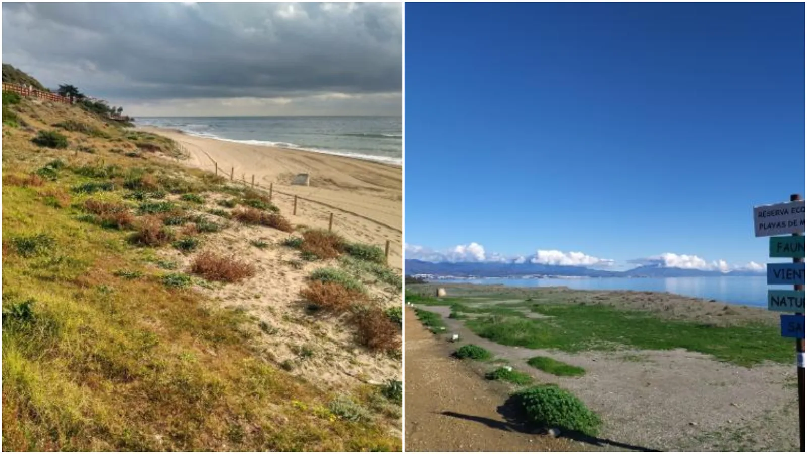

There are paths that lead to hidden beaches, others ascend towards mountains that dominate the horizon, and some traverse areas where nature and history move hand in hand. In the province of Málaga, only four routes have managed to maintain a distinction in 2026 that places them among the most outstanding environmental itineraries in the country. These are known as Blue Trails, routes that stand out for their ecological, scenic, and educational value, and have become true showcases of the natural heritage of Málaga.
The latest update by the Association for Environmental Education and the Consumer (ADEAC) has increased the number of recognized Blue Trails in Spain, from 154 to 194 awarded itineraries. Among the new additions, no Málaga route is listed, but the province still maintains the four trails distinguished last year with this prestigious environmental label.
What It Means to Be a Blue Trail
The Blue Trail program is an initiative promoted by ADEAC to recognize those paths and itineraries that stand out for the recovery and valorization of natural spaces. The distinction focuses on routes that favor environmental interpretation, knowledge of the territory, and the conservation of natural and cultural heritage.
The province of Málaga currently has four routes that meet these requirements: the Mijas Coastal Path, the Nerja Cave to Almijara Trail, the Pico del Cielo Trail, and the Manilva Beaches Trail.
Each offers a completely different experience, from accessible coastal walks to mountain ascents for experienced hikers.
The Mijas Coastal Path, Six Kilometers Along the Mediterranean
Among the Blue Trails of Málaga, the Mijas Coastal Path stands out, a six-kilometer route that connects La Luna beach with the urban center of La Cala de Mijas.
With an easy difficulty and an approximate duration of one and a half hours, this itinerary functions as a pedestrian and cyclist corridor that allows you to traverse a significant part of the Mijas coast. Throughout the journey, the Mediterranean constantly accompanies the visitor, while the route links some of the main beaches of this area of the Costa del Sol.
The route also crosses coastal ecosystems of environmental interest, including characteristic dune spaces of the Andalusian coast. The presence of flora and fauna adapted to this environment makes the trail a privileged space to observe the natural richness of the Málaga coast.
Along with the natural heritage, historical elements also appear, such as watchtowers, defensive constructions that for centuries guarded the coast and today are part of the landscape.
Nerja Cave to Almijara, a Journey Between Geology and Nature
The second of the Blue Trails in Málaga is located in Nerja. It is the Nerja Cave to Almijara Trail, a 1,890-meter-long itinerary with easy difficulty that can be completed in about two hours.
The route starts in the vicinity of the well-known Nerja Cave and enters the area of the Sierras de Tejeda, Almijara, and Alhama Natural Park. Beneath the walker's feet extends a complex karst system formed over thousands of years by the action of water on limestone.
The trail allows the discovery of the connection between the geological richness of the subsoil and the biodiversity that characterizes this natural space. The Mediterranean vegetation and wildlife are part of a landscape where the contrasts of colors and the tranquility of the mountain predominate.
Pico del Cielo, One of Nerja's Most Emblematic Routes
Also located in Nerja is the third Blue Trail of the province: the Pico del Cielo Trail. With a length of 7,106 meters, an approximate duration of four hours, and a high level of difficulty, this route leads to one of the most representative summits of the municipality. The Pico del Cielo reaches an altitude of 1,058 meters and is one of the great natural viewpoints of the region.
The route also starts near the Nerja Cave and ascends the well-known Cuesta del Cielo. During the climb, pine forests, old farmhouses, and areas of Mediterranean scrubland appear, offering wide views of the surroundings.
The physical demand of the itinerary is due both to the accumulated elevation and the environmental conditions of the route, characterized by the lack of shade and exposure to the sun. From the summit, on clear days, it is possible to contemplate extensive sectors of the Mediterranean coast and even see the mountains of North Africa.
Manilva Beaches Trail, Maintains Its Recognition
Last year's major novelty in this list was the Manilva Beaches Trail, which remains another year in the network of Blue Trails allowing Málaga to consolidate its four recognitions.
This coastal route has a length of 7,450 meters, an easy difficulty, and an estimated duration of three hours. Its layout runs through the Ecological Reserve Playas de Manilva, from Los Toros beach to Punta Chullera.
One of the aspects that most singularizes this route is the high degree of conservation of its environment. The limited urbanization of this coastal stretch has favored the preservation of important natural habitats.
During the journey, spaces as diverse as almost virgin beaches, including Negro beach, rocky coves like Sardina, and dune systems where sea daffodil, a plant species of notable ecological value, thrives appear.
The itinerary concludes at Punta Chullera, a place where remains of ancient watchtowers, including one of Nasrid origin, still exist, reminding us of the strategic importance this sector of the coast had throughout history.

Latest news




Upcoming events
12
Nov
El Desembarco, la traición de Viriato at La Caja Blanca
12
Nov
HOMER El Mero Mero at Sala Trinchera Málaga
13
Nov
Marbella Startup Lab – Innovate & Collaborate
13
Nov
Candlelight: Coldplay & Imagine Dragons at Sala Fundación Unicaja María Cristina
13
Nov
Candlelight: Tribute to Ludovico Einaudi at Anantara Villa Padierna
Similar News

Málaga Airport Makes History with More Than Three Million Passengers in One Month
Málaga

Port of Málaga looks beyond its docks to support future growth
Málaga
Guide to the Virgen del Carmen Processions in Málaga and the Province
Málaga