The secret route in Málaga with streams and forests that you can do in one morning and is ideal in spring
This trail in Gaucín surprises with its diversity of landscapes and ease. This village in Málaga fills with flowers in spring and becomes one of the most beautiful in Spain, captivating everyone who visits.
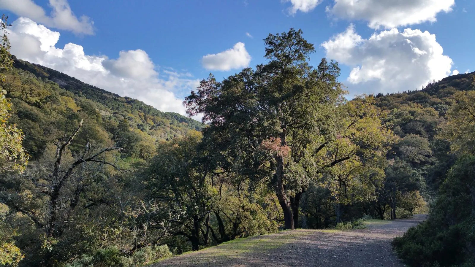

There are paths that do not appear on the most traveled maps, trails that make their way between the murmur of water and the silence of the trees, where spring is not only seen, but felt in every section. In the province of Málaga, this balance between nature, landscape, and accessible route is materialized in a specific trail that, without much fanfare, encapsulates much of the essence of the interior of Málaga.
The Garganta de las Palas Trail runs through the area of Gaucín, in the heart of the Serranía de Ronda, forming a circular itinerary of approximately 10 kilometers. Its estimated duration is around three hours, which allows it to be completed in one morning, especially during the spring, when the conditions of the natural environment favor the development of vegetation and the flow of streams.
It is a well-marked trail that combines sections of wide path with narrower ones, offering a varied route both in its layout and in the landscape. Throughout the itinerary, there are views of the characteristic white village of Gaucín, integrated into a mountainous environment of great natural richness.
Start of the trail: access and initial directions
The starting point is located next to Parque Antonio Godino, a space situated on the outskirts of the town, on the road connecting Algeciras with Ronda. From this location, the route begins by taking the main road in the opposite direction to the urban center, until finding a lane on the left clearly marked with the sign Ruta V - Garganta Las Palas and the reference to GR141 towards the Estación de Cortes.
The trail starts with a gradual descent through vegetation, passing several accesses to private properties until reaching a fork. About 20 minutes in, the path turns right and begins a slight climb. At this point, in front of a green fence, the route leaves the main lane to enter a narrower and rockier path, marked with the Roman numeral ‘V’.
Intermediate stretches between forests and natural signs
From this point, the route becomes more enveloping. The path descends and widens between trees until reaching a wire gate. After crossing it, the path continues with the fence on the left, entering a cork oak forest where yellow arrows painted on large specimens stand out as signage.
For about ten minutes, the descent is gentle until reaching a more open area. In this section, where the visibility of the path is reduced, the route heads left towards a lone pine surrounded by oaks. Shortly after, it connects with a lane identified as Camino Gaucín to Cortes, where the ‘V’ signage is resumed, turning left again to continue for about 30 minutes.
Another scene that the route offers.Changes in the landscape: streams and shaded areas
One of the most notable features of this route is the variability of the landscape. As the journey progresses, elements such as the Carboneras stream or the Hilos de Enmedio stream appear, accompanying the route and providing moisture and coolness to the environment. These watercourses are integrated into areas of dense vegetation, where oaks and pine forests predominate.
At a marked crossing, the path turns left again, starting a climbing section on a track that, after between 10 and 15 minutes, turns into a gentle descent. The path meanders between trees until reaching a new wire gate that marks approximately two-thirds of the total route.
Final stretch and return to the urban center
After passing this landmark, the trail continues uphill for about five minutes until reaching a large metal gate next to a building. At this point, the environment changes, with the presence of buildings and activity associated with private estates, such as the so-called Finca La Claridad, along which the path runs.
Powered by WikilocThe final stretch skirts various properties until reaching a 'T' junction, easily identifiable by the presence of a construction company and poultry in the surroundings. From there, the itinerary continues to the right following the track that leads to a gas station, marking the end of this circular route.

Latest news


Upcoming events
12
Nov
El Desembarco, la traición de Viriato at La Caja Blanca
12
Nov
HOMER El Mero Mero at Sala Trinchera Málaga
13
Nov
Marbella Startup Lab – Innovate & Collaborate
13
Nov
Candlelight: Coldplay & Imagine Dragons at Sala Fundación Unicaja María Cristina
13
Nov
Candlelight: Tribute to Ludovico Einaudi at Anantara Villa Padierna
Similar News

Málaga Airport Makes History with More Than Three Million Passengers in One Month
Málaga
Port of Málaga looks beyond its docks to support future growth
Málaga
Guide to the Virgen del Carmen Processions in Málaga and the Province
Málaga