

The A-372: A 37-Kilometre Scenic Drive Through the Sierra de Grazalema
Whitewashed villages, Mediterranean woodland, limestone cliffs and sweeping valleys line this Andalusian road, which climbs above 1,100 metres and reveals some of the finest scenery between Cádiz and Málaga.

A Scenic Route Between Cádiz and Málaga
Not every remarkable natural landscape requires a long hike. The A-372 shows that mountains, forests and valleys can also be explored by road, along a 37-kilometre route through the heart of the Sierra de Grazalema.
This regional highway connects Arcos de la Frontera with the A-374 towards Ronda. Recognised for its scenic value, it provides access to one of Andalusia’s most distinctive natural areas through a succession of bends, changing elevations and whitewashed villages.
From El Bosque to Puerto del Boyar
The road passes through places including El Bosque, Benamahoma and Grazalema. Starting at an elevation of around 300 metres, it gradually climbs above 1,100 metres at Puerto del Boyar, approximately 15 kilometres from the beginning of the section.
The scenery changes noticeably with altitude. Holm oaks, carob trees and livestock land characterise the lower areas, while the ascent leads into a more dramatic landscape of karst formations, rock walls and limestone ridges.
Between El Bosque and Benamahoma, the road curves around the upper reaches of the Majaceite River and continues along the slopes of the Sierra del Pinar. Beyond this point, the route becomes increasingly winding as it enters rugged terrain on its way to Puerto del Boyar.
Through the Heart of the Sierra de Grazalema
The A-372 crosses the Sierra de Grazalema Natural Park, which was designated a Biosphere Reserve in the late 1970s. The journey offers wide-ranging views across the El Bosque River valley, the Tavizna Valley and the Boyar corridor.
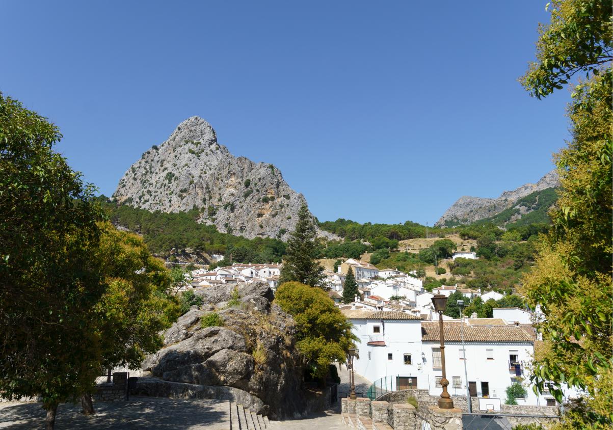
One of the route’s most striking features is the massive rock formation above Grazalema, which appears in the distance and gradually dominates the view as the road approaches the village.
The Sierra del Pinar, the limestone walls of Peñón Grande and clusters of Spanish firs also stand out. Although the protected core of the Grazalema fir forest can only be reached on foot, these endemic trees can be seen from several elevated sections and roadside viewpoints.
Woodland, Pastures and Open Horizons
Beyond Puerto de los Alamillos, the route passes through forests of cork and Portuguese oaks. This section also reveals traditional grazing land and areas associated with the region’s cork-harvesting heritage.
As the road winds through the countryside, it opens up new views of the Lagarín and Malaver mountains, the Zahara-El Gastor reservoir and the Mesas de Ronda. The changing scenery creates a continuous transition between river valleys, limestone peaks and rural landscapes shaped by generations of farming.
Two Viewpoints Along the Route
Two accessible viewpoints provide opportunities to stop and take in the surroundings. The Puerto del Boyar viewpoint stands at kilometre 44, at an altitude of 1,103 metres. From here, visitors can observe the divide between the Guadalete River, which flows east towards Grazalema, and the Tavizna River to the west.
A second viewpoint lies at kilometre 47, near the entrance to Grazalema. It includes parking, tables and a protected viewing area with railings. The location offers a broad panorama over the village’s whitewashed buildings and the Guadalete Valley.
Rather than simply connecting two destinations, the A-372 is a journey in its own right. Its villages, forests and mountains provide a memorable way to experience Andalusia’s natural beauty from the road.

Latest news




Upcoming events
17
Sep
La Pequeña Cuba Gastro-Cultural Festival in San Pedro Alcántara 2026
18
Sep
World Wellness Weekend Marbella 2026
18
Sep
Candlelight: Queen vs. ABBA in Málaga
18
Sep
Candlelight: Coldplay and Imagine Dragons in Málaga
18
Sep
3 de Corazones – Pancho Céspedes, Enrique Ramil and José Luis Jaén in Málaga